

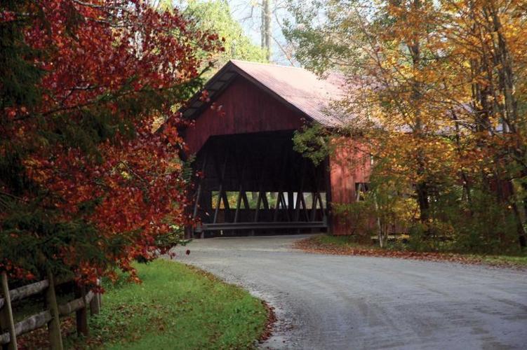

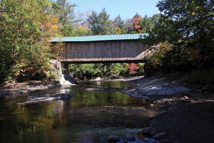


Vermont has more than 100 covered bridges, and there is no better time to see them than during fall foliage season. It’s a great time of year to get behind the wheel of a car and take a short road trip, scoping out the autumn colors and visiting some historic structures along the way.
Here is a trip that travels to 12 covered bridges, all in Lamoille County. The tour starts and ends in Stowe village, goes through Smugglers’ Notch, up to Waterville and Belvidere Junction, over to Johnson and back to Stowe. The tour is approximately 75 miles, so set your GPS, pack a picnic and get ready to see some beautiful scenery.
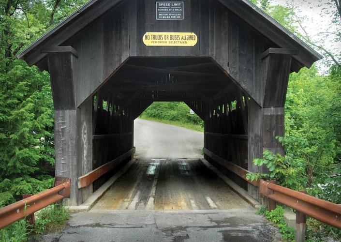
Emily’s Bridge
Located on Covered Bridge Road, Gold Brook Covered Bridge, more commonly known as Emily’s Bridge, is a 50-foot queen post truss design, built in 1884. No one knows who Emily was, but there are several anecdotes about her fate at the bridge: While on her way to a wedding, Emily’s horse bolted while crossing the bridge and she died of her injuries; Emily’s fiancé failed to show up at their wedding and she hung herself from the rafters; Emily became pregnant and her lover killed himself on the bridge, and Emily did the same after giving birth to twins. Emily supposedly haunts the bridge to this day.
Directions: Starting at the junction of Routes 108 and 100 in Stowe, head south on Route 100 for 1.7 miles. Turn left on Gold Brook Road and go 1.3 miles. Emily’s Bridge is on the left.
Brookdale Bridge
Built for the Whitecaps Corporation Housing Development in 1964, Brookdale is a “stringer” covered bridge, meaning it was made with stringers instead of traditional style trusses, and therefore is considered a non-authentic covered bridge. It spans the West Branch Waterbury River and originally had a hemlock shake roof, which was replaced with the current steel roof.
Directions: From Emily’s Bridge, return to Route 100, turn left and go 0.7 miles. Turn right on Moscow Road and go 1.5 miles, passing through Moscow. Turn right on Barrows Road and go 1.7 miles. Turn right on Luce Hill Road, which takes you to Route 108. Turn left and go 2.3 miles. Turn left on Brook Road. Brookdale Bridge is just ahead.
Grist Mill Bridge
Built in 1872, Grist Mill is a Burr arch covered bridge that spans the Brewster River in Jeffersonville. It is also known as the Scott Covered Bridge, Bryant Covered Bridge and Canyon Covered Bridge. Just before the bridge is Brewster River Park, with parking and picnic tables along the river. Just after the bridge is the Alden Bryan Brewster River Trail, which leads to Brewster River Gorge. The trail is less than a half-mile and well worth an excursion to the waterfalls in the gorge.
Directions: From the Brookdale Bridge, go back to Route 108, turn left and go 12.4 miles, passing by Stowe Mountain Resort and through Smugglers’ Notch. Just before the village of Jeffersonville, make a sharp right onto Canyon Road. Grist Mill Bridge is just ahead.
Cambridge Junction Bridge
Also known as the Poland Covered Bridge, this is a 152-foot Burr arch bridge that crosses the Lamoille River in Jeffersonville. Built by George W. Holmes in 1887, it was named for a local official, Judge Poland, and stirred up considerable controversy when it was build due to its expense (between $6,000 and $10,000, according to an 1888 article in the News and Citizen newspaper).
Directions: From Grist Mill Bridge, continue on Canyon Road for 1.1 miles. Turn left on Junction Hill Road and go 1.2 miles. Take a left on Route 15 and an immediate right on Cambridge Junction Road (no street sign). The bridge is 100 feet ahead.
Church Street Bridge
Also called the Village Covered Bridge, Church Street Bridge is a sweet little 61-foot queen post truss design in the heart of Waterville, just off Route 109. Built in 1877, it crosses the North Branch Lamoille River. It was listed on the National Register of Historic Places in 1974.
Directions: From Cambridge Junction Bridge, return to Route 15 via Cambridge Junction Road. Turn right and go 1.2 miles to Jeffersonville. At the roundabout, go right on Route 108 and then right on Route 109 and go 4.4 miles. Turn left on Church Street. The bridge is just ahead.
Montgomery Covered Bridge
The Montgomery Covered Bridge crosses the North Branch Lamoille River in Waterville. It’s a 70-foot queen post truss/lattice-style bridge built in 1898. In 1969, a snowstorm dumped five feet on the bridge, causing it to lean. Dallas Montgomery, a farmer for whom the bridge is now named, climbed on the roof to remove the snow, while Wilmer Locke winched the bridge upright and added bracing. In 1971, an asphalt truck fell through the deck into the river below. Luckily, the driver was not seriously hurt. The bridge was then reinforced with steel beams.
Directions: From Church Street Bridge, return to Route 109 and turn left. Go 1.2 miles and turn right on Montgomery Road. You can’t miss it.
Jaynes Bridge
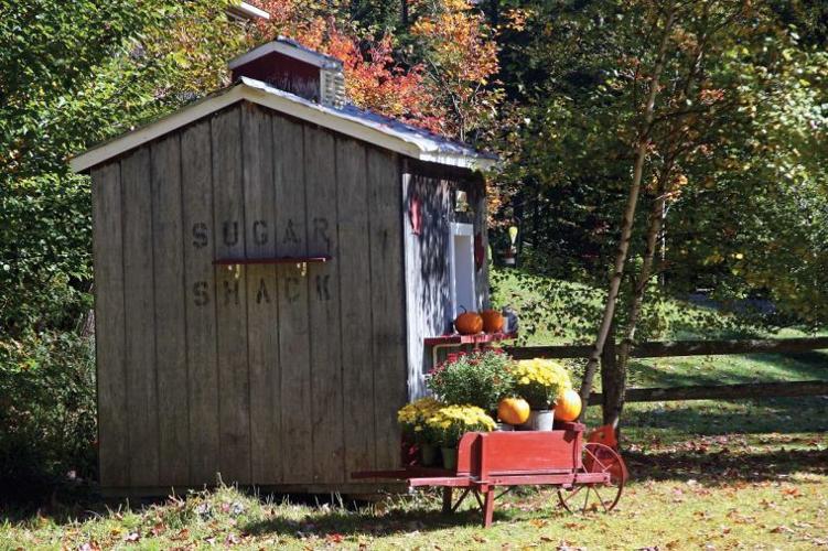
Crossing the North Branch Lamoille River in Waterville, Jaynes Bridge was built in 1887 in the same style as the Montgomery bridge. It was named for a family that lived nearby. In 1960, after an accident involving a gravel-filled dump truck that fell through the floor, the bridge was reconstructed and reinforced with four steel beams. A new steel roof was installed in 2001. The bridge provides the only access to the farms and homes in Codding Hollow. Today, Bert and Lois Gillespie sell maple syrup from a sugar shack just before the bridge.
Directions: From Montgomery Bridge, return to Route 109 and turn right. Go 0.5 miles and turn right on Codding Hollow Road.
Mill Bridge
Mill Bridge, also called Lumber Mill Bridge, crosses the North Branch Lamoille River in Belvidere, on Back Road. It’s a queen post truss design, built by Lewis Robinson in 1895. In 1971, after a snowplow broke through, steel beams were installed under the bridge’s deck.
Directions: From Janyes Bridge, return to Route 109 and turn right. Go 2.1 miles and turn left on Back Road, just after Belvidere Junction. Go 0.5 miles to the bridge.
Morgan Bridge
The 70-foot Morgan Bridge — the fifth bridge on this tour to cross the North Branch Lamoille River — is of the same construction as the Montgomery and Jaynes bridges. It is located in Belvidere and was built by Lewis Robinson in 1887. This bridge has never had any major reconstruction, except for a standing seam metal roof.
Directions: From Mill Bridge, continue on Back Road for 0.7 miles. Turn right on Morgan Bridge Road and it’s right there.
Power House Covered Bridge
The Power House Bridge in Johnson crosses the Gihon River. It’s a 63-foot queen post truss bridge built in 1872. Also called School Street Covered Bridge, the Power House Bridge was named for a now obsolete hydroelectric generating station just upstream. In 2000, the roof collapsed under a heavy snow load and the side walls fell into the river below. In 2002, the Blow & Cote construction company reconstructed the bridge and it reopened that year.
Directions: From Morgan Bridge, continue on Morgan Bridge Road for less than a half-mile to Route 109. Turn right and retrace your route for almost 5 miles, passing through Waterville. Turn left on Plot Road and bear right at the fork in the road. After 6.1 miles on Plot Road, turn right on Clay Hill Road and go almost a mile. Turn left on School Street and go 0.5 miles.
Scribner Bridge
The 48-foot Scribner Covered Bridge, also known as Mudgett Covered Bridge, crosses the Gihon River off Route 100C in Johnson. The date the queen post truss bridge was built is unknown, but it is thought, due to the relatively low height of the trusses, to have once been an uncovered pony truss bridge.
Directions: From Power House Bridge, turn left on Route 100C. Go one mile and turn right on Rocky Road. Scribner Bridge is just head.
Red Bridge
Built in 1896, Red Bridge is, and probably always will be, red. Located in Morrisville, it’s a 66-foot king post and queen post truss system design. It carries Cole Hill Road over the Sterling Brook to Sterling Valley Road.
Directions: From Scribner Bridge in Johnson, return to Route 100C and turn left. In 1.4 miles you will enter Johnson. Turn left on Route 15 and go 4.1 miles. Turn right on Johnson Street Extension, then left on Main Street in Hyde Park. Go through Hyde Park, turn right on Depot Street and go 1.3 miles. Turn right on Stagecoach Road and continue straight through the four-way intersection. Continue straight for almost 4 miles and turn right on Sterling Valley Road. Go 1.6 miles and you’ll it on the right.
Directions back to Stowe: Retrace your route on Sterling Valley to Stagecoach Road. Turn right and go 0.7 miles to Route 100. Turn right and go 1.8 miles to Stowe village.


(0) comments
Welcome to the discussion.
Log In
Keep it clean. Please avoid obscene, vulgar, lewd, racist or sexual language.
PLEASE TURN OFF YOUR CAPS LOCK.
Don't threaten. Threats of harming another person will not be tolerated.
Be truthful. Don't knowingly lie about anyone or anything.
Be nice. No racism, sexism or any sort of -ism that is degrading to another person.
Be proactive. Use the "Report" link on each comment to let us know of abusive posts.
Share with us. We'd love to hear eyewitness accounts, the history behind an article.